A selection of some of our favourite walks around Greensand Commons for you to enjoy.
We have provided downloadable pdfs of walking route instructions and maps for you to explore these walking routes around the Commons. You can also download them as GPX files.
The easiest way to open a GPX file and view the map data it contains is by uploading it to the web version of Google Maps. After you open and sign in to Google Maps in your web browser, you can add a GPX file as a new map by:
- Opening the Google Maps menu and selecting Your places.
- Selecting Maps → Create map.
- A new Google Maps window opens. In that window, select the Import button that appears underneath the Untitled layer.
- Upload your GPX file. The map data the file contains will appear in Google Maps.
You can also open a GPX file in a variety of desktop and mobile applications, including Strava and AllTrails.
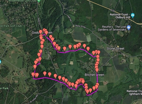
Fawke and Bitchet Commons walking route - 4 miles
This 4-mile walk starts and finishes at Godden Green, a modest green that supports a wide variety of native wildflowers and pollinators. The Bucks Head pub overlooks Godden Green, making an ideal spot for lunch. From Godden Green, walkers will head through the tranquil woodland of Fawke Common, eventually reaching Bitchet Common. While exploring Bitchet Common, walkers will pass the remains of old chert quarries, which were once used to extract materials for road making. In recent years, works have been undertaken to restore pockets of rare lowland heathland at the site.
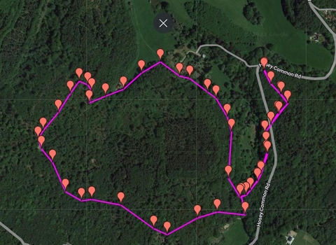
Crockham Hill Common - 2 miles
A short walk with some steep hills that passes through quiet, broadleaved semi-natural and replanted woodland. Walkers will encounter pockets of lowland heath, one of Kent’s rarest habitats. This peaceful walk is ideal for observing birds, including rooks, long-tailed tits, great tits, blue tits, various finches and Britain’s tiniest bird, the goldcrest.
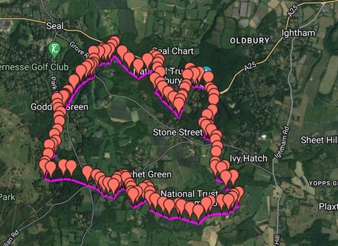
Fawke, Bitchet and Seal Chart - 8 miles
This invigorating trail runs through Fawke, Bitchet and Seal Chart Commons. Fawke boasts several mature, veteran trees, which support a variety of insects and fungi. Bitchet Common offers a wide range of trees, including yew, rowan, sweet chestnut, silver birch and oak. Woodland birds thrive here, including greater-spotted and green woodpeckers. Seal Chart Common provides an excellent view of the wider landscape and is frequented by flocks of chatty blue, great and long-tailed tits. Some walkers may find the steep hills on this route challenging.
